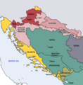
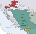
파일:Map of the Kingdom of Croatia (1868).png
Map_of_the_Kingdom_of_Croatia_(1868).png (542 × 502 픽셀, 파일 크기: 40 KB, MIME 종류: image/png)
파일 역사
날짜/시간 링크를 클릭하면 해당 시간의 파일을 볼 수 있습니다.
| 날짜/시간 | 섬네일 | 크기 | 사용자 | 설명 | |
|---|---|---|---|---|---|
| 현재 | 2022년 11월 11일 (금) 03:35 |  | 542 × 502 (40 KB) | CarRadovan | Reverted to version as of 22:47, 17 December 2016 (UTC) |
| 2017년 2월 12일 (일) 13:43 |  | 542 × 552 (39 KB) | Ceha | Reverted to version as of 10:26, 17 December 2016 (UTC) as discussed before | |
| 2016년 12월 18일 (일) 07:47 |  | 542 × 502 (40 KB) | Lilic | Reverted to version as of 11:51, 13 October 2009 (UTC) reverting to author's original map, as it is in fact better | |
| 2016년 12월 17일 (토) 19:26 |  | 542 × 552 (39 KB) | Ceha | Showed croatian aspirations (pale orange), marked Slavonia as area which sended representatives in croatian parliament, as well as military borders which were part (at least in it's names) of Croatia and Slavonia. | |
| 2009년 10월 13일 (화) 20:51 |  | 542 × 502 (40 KB) | DIREKTOR | {{Information |Description={{en|1=Map of the Kingdom of Croatia (red) in late 1867 and early 1868 (before the Croatian-Hungarian Nagodba and the establishment of the Kingdom of Croatia-Slavonia). The Kingdom of Slavonia was independent of Croatia at the t | |
| 2009년 10월 13일 (화) 20:49 |  | 542 × 502 (40 KB) | DIREKTOR | {{Information |Description={{en|1=Map of the Kingdom of Croatia (red) in late 1867 and early 1868 (before the Croatian-Hungarian Nagodba and the establishment of the Kingdom of Croatia-Slavonia). The Kingdom of Slavonia was independent of Croatia at the t | |
| 2009년 10월 13일 (화) 20:45 |  | 542 × 502 (40 KB) | DIREKTOR | {{Information |Description={{en|1=Map of the Kingdom of Croatia (red) in late 1867 and early 1868 (before the Croatian-Hungarian Nagodba and the establishment of the Kingdom of Croatia-Slavonia). The Kingdom of Slavonia was independent of Croatia at the t | |
| 2009년 10월 11일 (일) 19:04 |  | 542 × 502 (39 KB) | DIREKTOR | {{Information |Description={{en|1=Map of the Kingdom of Croatia (red) in late 1867 and early 1868 (before the Croatian-Hungarian Nagodba and the establishment of the Kingdom of Croatia-Slavonia). The Kingdom of Slavonia was independent of Croatia at the t | |
| 2009년 10월 9일 (금) 01:39 |  | 542 × 502 (38 KB) | DIREKTOR | {{Information |Description={{en|1=Map of the Kingdom of Croatia (red) in late 1867 and early 1868 (before the Croatian-Hungarian Nagodba and the establishment of the Kingdom of Croatia-Slavonia). The Kingdom of Slavonia was independent of Croatia at the t | |
| 2009년 10월 8일 (목) 21:47 |  | 542 × 502 (38 KB) | DIREKTOR | {{Information |Description={{en|1=Map of the Kingdom of Croatia (red) in late 1867 and early 1868 (before the Croatian-Hungarian Nagodba and the establishment of the Kingdom of Croatia-Slavonia). The Kingdom of Slavonia was independent of Croatia at the t |
이 파일을 사용하는 문서
다음 문서 1개가 이 파일을 사용하고 있습니다:
이 파일을 사용하고 있는 모든 위키의 문서 목록
다음 위키에서 이 파일을 사용하고 있습니다:
- azb.wikipedia.org에서 이 파일을 사용하고 있는 문서 목록
- bg.wikipedia.org에서 이 파일을 사용하고 있는 문서 목록
- bs.wikipedia.org에서 이 파일을 사용하고 있는 문서 목록
- cs.wikipedia.org에서 이 파일을 사용하고 있는 문서 목록
- el.wikipedia.org에서 이 파일을 사용하고 있는 문서 목록
- en.wikipedia.org에서 이 파일을 사용하고 있는 문서 목록
- es.wikipedia.org에서 이 파일을 사용하고 있는 문서 목록
- et.wikipedia.org에서 이 파일을 사용하고 있는 문서 목록
- eu.wikipedia.org에서 이 파일을 사용하고 있는 문서 목록
- fi.wikipedia.org에서 이 파일을 사용하고 있는 문서 목록
- hu.wikipedia.org에서 이 파일을 사용하고 있는 문서 목록
- it.wikipedia.org에서 이 파일을 사용하고 있는 문서 목록
- ja.wikipedia.org에서 이 파일을 사용하고 있는 문서 목록
- lv.wikipedia.org에서 이 파일을 사용하고 있는 문서 목록
- mk.wikipedia.org에서 이 파일을 사용하고 있는 문서 목록
- nl.wikipedia.org에서 이 파일을 사용하고 있는 문서 목록
- pt.wikipedia.org에서 이 파일을 사용하고 있는 문서 목록
- ro.wikipedia.org에서 이 파일을 사용하고 있는 문서 목록
- ru.wikipedia.org에서 이 파일을 사용하고 있는 문서 목록
- sh.wikipedia.org에서 이 파일을 사용하고 있는 문서 목록
- sl.wikipedia.org에서 이 파일을 사용하고 있는 문서 목록
- sr.wikipedia.org에서 이 파일을 사용하고 있는 문서 목록
- sv.wikipedia.org에서 이 파일을 사용하고 있는 문서 목록
- tr.wikipedia.org에서 이 파일을 사용하고 있는 문서 목록
- uk.wikipedia.org에서 이 파일을 사용하고 있는 문서 목록
- www.wikidata.org에서 이 파일을 사용하고 있는 문서 목록

