
파일:Neighborhoods Evacuated as Kincade Fire Spreads (48953815948).jpg
미리 보기 크기: 800 × 450 픽셀 다른 해상도: 320 × 180 픽셀 | 640 × 360 픽셀 | 1,024 × 576 픽셀 | 1,280 × 720 픽셀 | 1,920 × 1,080 픽셀
원본 파일 (1,920 × 1,080 픽셀, 파일 크기: 972 KB, MIME 종류: image/jpeg)
.jpg?uselang=ko)
파일 설명
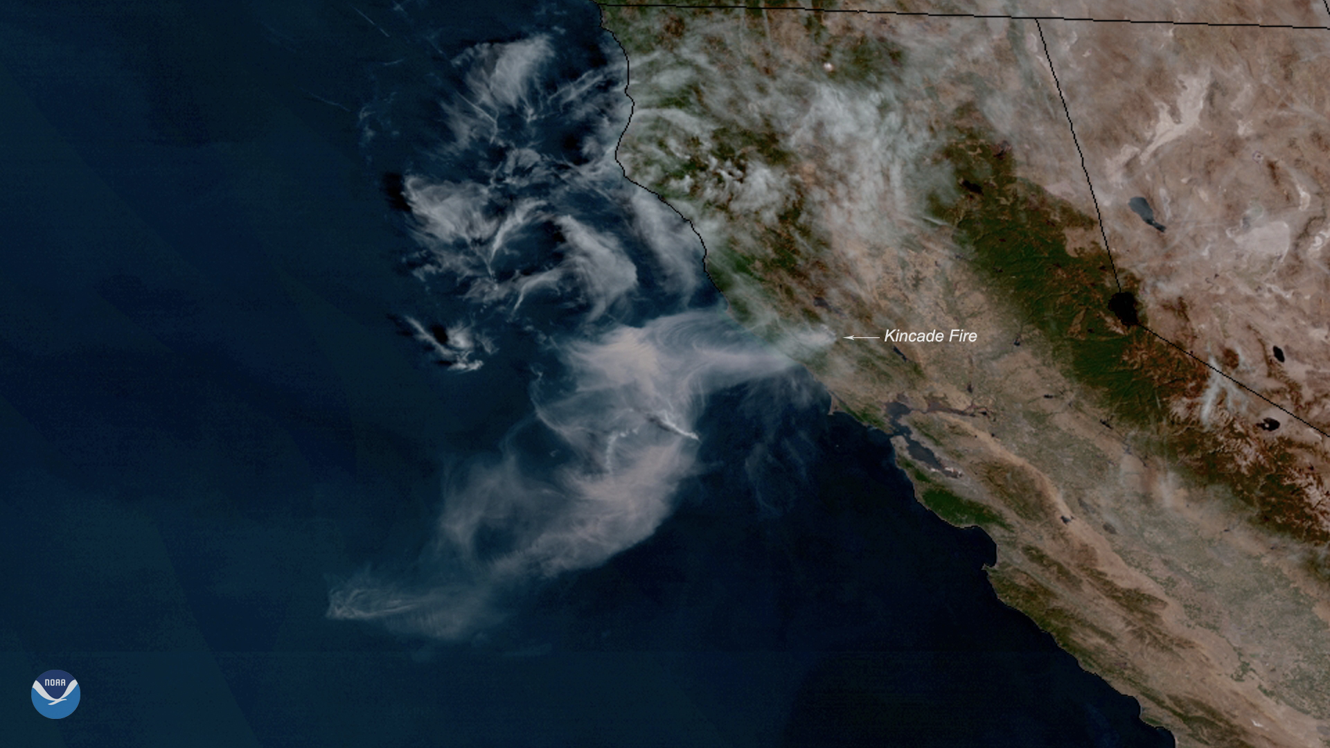
| 설명 | Neighborhoods across parts of Sonoma County, California, are under evacuation orders, and more are expected as the Kincade Fire continues to spread toward Cloverdale. The wildfire, seen here by NOAA's GOES West on Oct. 24, 2019, grew to 10,000 acres overnight, and wind gusts of 35-45 mph continue to aid its rapid expansion. The Kincade Fire was first reported around 9:30 p.m. PT on Wednesday just northeast of the town of Geyserville, according to a Cal Fire incident report. Early Thursday morning, the County of Sonoma issued a mandatory evacuation order for all Geyserville residents, noting that the fire had crossed Highway 128 near Moody Lane and was spreading westward. Much of the Sacramento area, which is located about 80 miles east of Geyserville, is under a Red Flag Warning until 4 p.m. This means critical fire weather conditions, which include a combination of strong winds, low relative humidity, and warm temperatures, are occurring or imminent, according to the National Weather Service. This GeoColor enhanced imagery was created by NOAA's partners at the Cooperative Institute for Research in the Atmosphere. The GOES West satellite, also known as GOES-17, provides geostationary satellite coverage of the Western Hemisphere, including the Western United States, the Pacific Ocean, Alaska, and Hawaii. First launched in March 2018, the satellite became fully operational in February 2019. |
| 날짜 | |
| 출처 | Neighborhoods Evacuated as Kincade Fire Spreads |
| 저자 | NOAA Satellites |
라이선스
|
|
| 이 이미지는 https://flickr.com/photos/125201706@N06/48953815948 에서 NOAASatellites에 의하여 플리커에 처음 게시되었습니다. 이것을 FlickreviewR 2 로봇이 검토하였고, Public Domain Mark의 조건에 따른 라이선스임을 확인하였습니다. |
파일 역사
날짜/시간 링크를 클릭하면 해당 시간의 파일을 볼 수 있습니다.
| 날짜/시간 | 섬네일 | 크기 | 사용자 | 설명 | |
|---|---|---|---|---|---|
| 현재 | 2019년 10월 29일 (화) 11:53 | | 1,920 × 1,080 (972 KB) | Daniel Mietchen | Transferred from Flickr via #flickr2commons |
이 파일을 사용하는 문서
다음 문서 1개가 이 파일을 사용하고 있습니다:
이 파일을 사용하고 있는 모든 위키의 문서 목록
다음 위키에서 이 파일을 사용하고 있습니다:
- en.wikipedia.org에서 이 파일을 사용하고 있는 문서 목록
- www.wikidata.org에서 이 파일을 사용하고 있는 문서 목록
.jpg)