
파일:PIA16132-MarsCuriosityRover-CalibrationTarget-20120909.jpg

원본 파일 (1,991 × 1,852 픽셀, 파일 크기: 260 KB, MIME 종류: image/jpeg)
파일 설명
| 설명 |
English: 09.10.2012
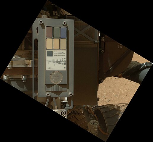
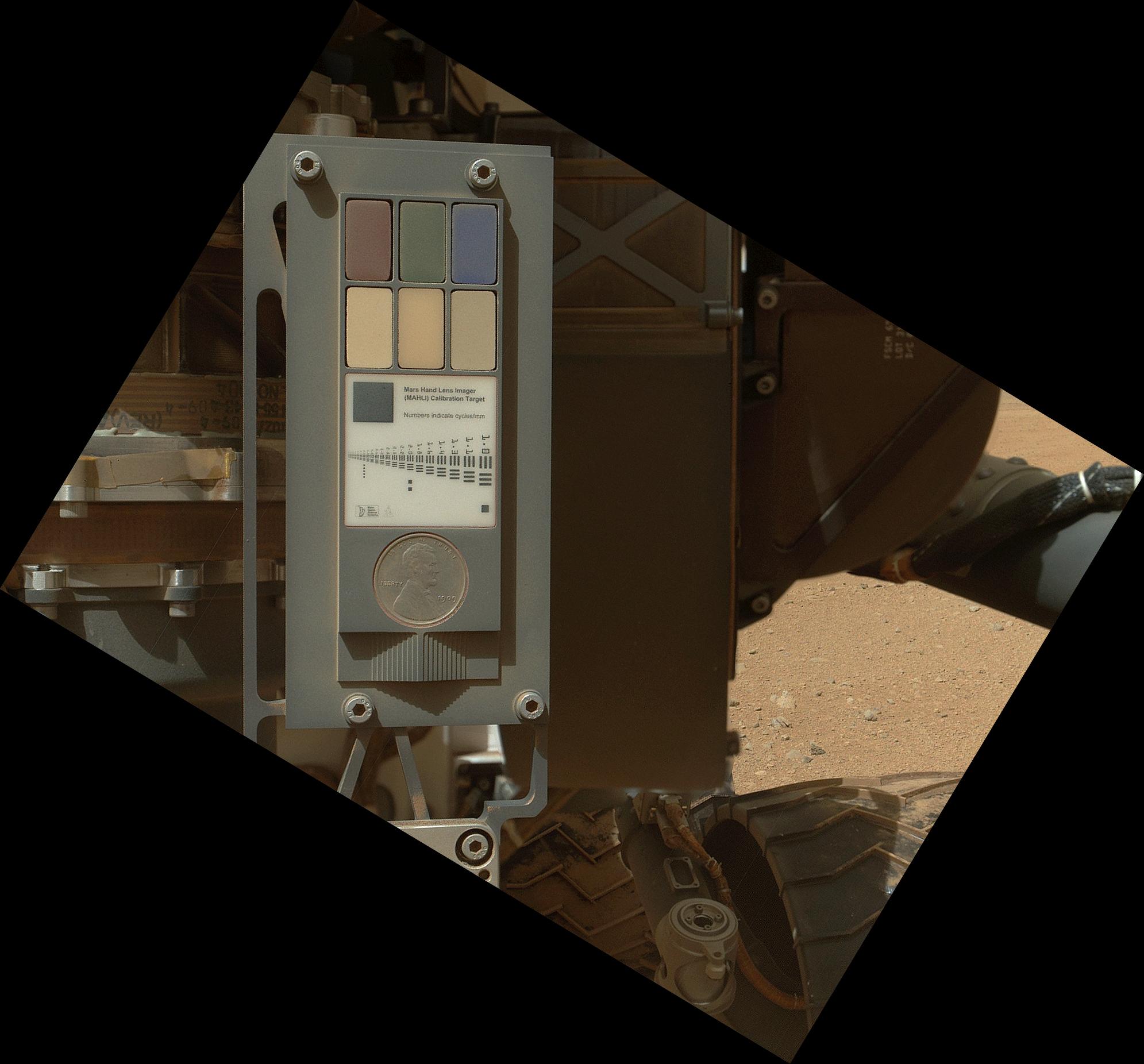
Calibration Target for Curiosity's Arm Camera This view of the calibration target for the Mars Hand Lens Imager (MAHLI) aboard NASA's Mars rover Curiosity combines two images taken by that camera during the 34th Martian day, or sol, of Curiosity's work on Mars (Sept. 9, 2012). Part of Curiosity's left-front and center wheels and a patch of Martian ground are also visible. The camera is in the turret of tools at the end of Curiosity's robotic arm. Its calibration target is on the rover body near the base of the arm. The Sol 34 imaging by MAHLI was part of a week-long set of activities for characterizing the movement of the arm in Mars conditions. MAHLI has adjustable focus. The camera took two images with the same pointing: one with the calibration target in focus and one with the wheel and Martian ground in focus. The view here combines in-focus portions from these shots. The calibration target for the Mars Hand Lens Imager (MAHLI) instrument includes color references, a metric bar graphic, a 1909 VDB Lincoln penny, and a stair-step pattern for depth calibration. The penny is a nod to geologists' tradition of placing a coin or other object of known scale as a size reference in close-up photographs of rocks, and it gives the public a familiar object for perceiving size easily when it will be viewed by MAHLI on Mars. The new MAHLI images show that the calibration target has a coating of Martian dust on it. This is unsurprising - the target was facing directly toward the plume of dust stirred up by the sky crane's descent engines during the final phase of the 6 August 2012 landing. The main purpose of Curiosity's MAHLI camera is to acquire close-up, high-resolution views of rocks and soil at the rover's Gale Crater field site. The camera is capable of focusing on any target at distances of about 0.8 inch (2.1 centimeters) to infinity, providing versatility for other uses. Image Credit: NASA/JPL-Caltech/Malin Space Science Systems |
| 날짜 | |
| 출처 | http://photojournal.jpl.nasa.gov/jpeg/PIA16132.jpg |
| 저자 | NASA/JPL-Caltech/Malin Space Science Systems |
| 다른 버전 | http://photojournal.jpl.nasa.gov/catalog/PIA16132 |
라이선스
| 이 파일은 NASA에서 제작하였으므로 퍼블릭 도메인입니다. NASA의 저작권 정책에 따르면 NASA의 자료는 명시하지 않는 이상 저작권의 보호를 받지 않습니다. (Template:PD-USGov, 또는 NASA 저작권 정책 문서, JPL 그림 사용 정책을 참고하세요.) | ||
 |
주의사항:
|
파일 역사
날짜/시간 링크를 클릭하면 해당 시간의 파일을 볼 수 있습니다.
| 날짜/시간 | 섬네일 | 크기 | 사용자 | 설명 | |
|---|---|---|---|---|---|
| 현재 | 2012년 10월 12일 (금) 22:52 | | 1,991 × 1,852 (260 KB) | Drbogdan | User created page with UploadWizard |
이 파일을 사용하는 문서
다음 문서 1개가 이 파일을 사용하고 있습니다:
이 파일을 사용하고 있는 모든 위키의 문서 목록
다음 위키에서 이 파일을 사용하고 있습니다:
- bn.wikipedia.org에서 이 파일을 사용하고 있는 문서 목록
- en.wikipedia.org에서 이 파일을 사용하고 있는 문서 목록
- es.wikipedia.org에서 이 파일을 사용하고 있는 문서 목록
- fa.wikipedia.org에서 이 파일을 사용하고 있는 문서 목록
- fr.wikipedia.org에서 이 파일을 사용하고 있는 문서 목록
- kk.wikipedia.org에서 이 파일을 사용하고 있는 문서 목록
- ru.wikipedia.org에서 이 파일을 사용하고 있는 문서 목록
- test.wikipedia.org에서 이 파일을 사용하고 있는 문서 목록
- uk.wikipedia.org에서 이 파일을 사용하고 있는 문서 목록
- zh.wikipedia.org에서 이 파일을 사용하고 있는 문서 목록