
파일:SutherlandTraditional.png
최대 해상도입니다.
SutherlandTraditional.png (420 × 520 픽셀, 파일 크기: 12 KB, MIME 종류: image/png)
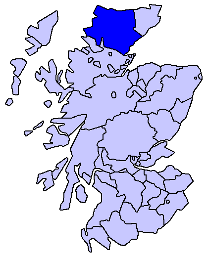
Sutherland county
Enlarged version of a map originally drawn by Morwen

|
GNU 자유 문서 사용 허가서 1.2판 또는 자유 소프트웨어 재단에서 발행한 이후 판의 규정에 따라 본 문서를 복제하거나 개작 및 배포할 수 있습니다. 본 문서에는 변경 불가 부분이 없으며, 앞 표지 구절과 뒷 표지 구절도 없습니다. 본 사용 허가서의 전체 내용은 GNU 자유 문서 사용 허가서 부분에 포함되어 있습니다. |
| 이 파일은 크리에이티브 커먼즈 저작자표시-동일조건변경허락 3.0 Unported 라이선스로 배포됩니다. | ||
| ||
| 이 라이선스 틀은 GFDL 라이선스 변경의 일부로 이 파일에 추가되었습니다. |
파일 역사
날짜/시간 링크를 클릭하면 해당 시간의 파일을 볼 수 있습니다.
| 날짜/시간 | 섬네일 | 크기 | 사용자 | 설명 | |
|---|---|---|---|---|---|
| 현재 | 2005년 5월 19일 (목) 01:23 | | 420 × 520 (12 KB) | Voyager | Sutherland county Enlarged version of a map originally drawn by Morwen {{GFDL}} Category:Maps of Scottish traditional counties |
이 파일을 사용하는 문서
다음 문서 1개가 이 파일을 사용하고 있습니다:
이 파일을 사용하고 있는 모든 위키의 문서 목록
다음 위키에서 이 파일을 사용하고 있습니다:
- de.wikipedia.org에서 이 파일을 사용하고 있는 문서 목록
- eo.wikipedia.org에서 이 파일을 사용하고 있는 문서 목록
- eu.wikipedia.org에서 이 파일을 사용하고 있는 문서 목록
- Inverness
- Highland
- Eskoziako Lur Garaiak
- Fort William (Eskozia)
- Eilean Donan
- Lankide:Euskaldunaa
- Kyle of Lochalsh
- Ullapool
- Nairn
- Portree
- Broadford (Eskozia)
- John o' Groats
- Kingussie
- Aviemore
- Kyleakin
- Glenfinnan
- Dornoch
- Thurso (Eskozia)
- Txantiloi:Highland
- Alness
- Brora
- Dingwall
- Fortrose
- Grantown-on-Spey
- Invergordon
- Inverlochy (Highland)
- Mallaig
- Tain
- Wick (Caithness)
- Abernethy and Kincardine
- Achnahannet (Strathspey)
- Advie
- Alvie
- Arpafeelie
- Artafallie
- Aundorach
- Avielochan
- Avoch
- Boat of Garten
- Bogroy
- Bishop Kinkell
- Carrbridge
- Catlodge
- Charlestown (Black Isle)
- Coylumbridge
- Conon Bridge
- Croftnacreich
- Cromarty
이 파일의 더 많은 사용 내역을 봅니다.